
Walk a Huntsville Street Directory
A sound address search moves from place to record, then from record to person. The assessed owner is a documented link to the land, not a list of everyone at the site. Start with the exact street form. Huntsville addresses use a house number, street name, street type, and quadrant. Only the number and name are required, but the type and NW, NE, SE, or SW quadrant can prevent a false match.
- Resolve the address in the city or county map and confirm which county holds the parcel. Huntsville reaches Madison, Limestone, and Morgan counties.
- Run the house number and street text through the Madison County Tax Assessor when the parcel falls in Madison County. Save the PIN, parcel, account, situs address, and owner.
- Inspect the same parcel and adjoining shapes in GIS. Treat the map as a navigation aid, then confirm assessment facts in the tax roll.
- Search the current owner as a grantee in Probate records. Follow each seller backward while matching the legal description, not just the house number.
- Add voter material only through its lawful access route, and use reverse directories for dated evidence of prior occupants.
The sequence keeps unlike claims separate. An assessment ties a named owner to a parcel. A deed documents a transfer. A reverse directory may tie an occupant to an address in one publication year. None alone proves the full household.
Place Huntsville Streets by County
A Huntsville postal line does not establish the records office. Madison County is the main jurisdiction, yet western and southern city limits also reach Limestone and Morgan counties. The city first crossed into Morgan County in 2018 through an annexation south of the Tennessee River. That makes county identification more than a filing detail. A blank Madison County result may mean the street belongs in another county system.
Use Huntsville GIS city-limit and annexation layers to place the parcel at the date that matters. The annexation series covers 1811 through 1949, decade layers from the 1950s through the 2020s, and individual 2025 and 2026 layers. Historical jurisdiction can differ from the parcel's current municipal status. For a whole street, check each end rather than assuming every lot shares one county.
Once the county is known, the assessor supplies the authoritative assessment link and the recorder supplies title evidence. That county-first habit is the most important local safeguard in a Huntsville street directory.
Search Huntsville Streets in AssuranceWeb
The Madison County Tax Assessor property search provides the strongest current address index for Madison County parcels. In Address mode, put the house number in the first search box and street text in the optional second box. Results can be sorted, printed, and shown in page sizes from five to fifty.
| Portal control | Entry type | Required | Huntsville address use |
|---|---|---|---|
| Tax Year | Dropdown | Yes | Selects an available assessment year; current portal view is 2026. |
| Search By | Radio choice | Yes | Name, PIN, Company, Parcel, Account, Subdivision, or Address. |
| Search | Text, 50 characters | Yes | House number when Address mode is active. |
| Search optional | Text, 50 characters | No | Street text in Address mode. |
| Search button | Action | Yes | Returns sortable parcel and tax rows. |
The result grid shows details, description, account, parcel, tax year, billing year, PIN, total tax, and balance. The underlying parcel card also distinguishes physical address from billing data. Save the stable parcel identifiers before moving to deeds or maps because names and street labels can change.
The captured Madison County CityView Property Locator shows how the alternate locator accepts a street address or PPIN.
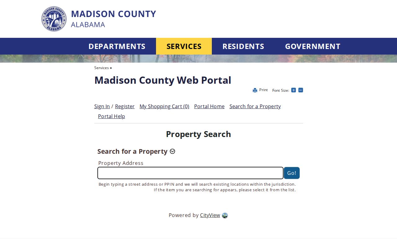
Its address autocomplete is useful for locating the right record, while the assessor and recorded deed remain the better sources for assessment and title claims.
Read Huntsville Address Clues Correctly
The most useful street-directory distinction is easy to miss. A situs address is the physical location of the parcel. The owner's mailing or billing address is where notices go. A different mailing address may suggest an owner lives elsewhere, but it does not prove who occupies the parcel. Homestead status can support owner occupancy; it still cannot identify renters, relatives, or other household members.
- Parcel
- A mapped unit of land used by the assessor and recorder.
- Situs address
- The physical street location assigned to the parcel.
- Plat
- A recorded map showing lots, blocks, streets, easements, and subdivision layout.
- Criss-cross directory
- A directory ordered by address or phone number instead of only by surname.
PIN, account, and parcel numbers are better cross-system keys than a person's name. They help separate two similar addresses and link the assessment row to a mapped lot. A subdivision and legal description then connect that lot to the deed index. Read all three address forms before drawing a conclusion.
Note: A mailing address is an ownership clue, not evidence that the owner lives at the property or that no one else does.
Huntsville Records Indexed by Address
No single Huntsville street directory contains every current resident. Instead, each address-keyed source adds a defined kind of evidence. The table separates the keeper, the claim, and the fallback when a web portal does not answer the question.
| Address record | Official keeper | What it establishes | Access route |
|---|---|---|---|
| Assessment and tax roll | Madison County Tax Assessor and Collector | Owner, situs, billing, PIN, parcel, value, and exemption | Free web search; office help |
| Parcel maps | County revenue GIS and Huntsville GIS | Lot shape, adjacent land, streets, and public layers | Free interactive viewers |
| Deeds, mortgages, and liens | Madison County Probate Judge | Recorded parties, instrument, date, and legal description | Free-account portal; appointment, mail, electronic request, or archive |
| Plats and subdivisions | Probate and GIS | Lot, block, easements, and street layout | Recorded plats and map links |
| Permits and code material | Huntsville Inspection and city records | Project address and named applicant or contractor | GIS, department inquiry, or city records request |
| Reverse directories | HMCPL and historical repositories | Occupants listed at an address in a publication year | Digitized issue or library access |
Permits show work and participants, not a household. GIS shapes are not legal surveys. Tax balances do not change the meaning of ownership. Keeping those limits beside the data prevents a street list from becoming an unsupported resident list.
Link Huntsville Parcels to Deeds
The Madison County recorded-document portal requires a free account, and the county says both account creation and documents available in the system are free. Its public landing page does not state a reliable earliest online year. Do not infer that a missing web result means no deed exists.
Start with the assessed owner, then search that person or entity as grantee, the party receiving property. Open the acquisition deed and note the grantor, the party transferring it, along with the recording date and legal description. Search that grantor as an earlier grantee. Repeat only when the lot, block, subdivision, or metes-and-bounds description stays continuous. A reused house number is not enough.
When the online run ends, contact the Madison County Probate Judge. Recording and Probate services are at 1918 Memorial Parkway NW. Direct land-record access needs an appointment at least one business day ahead; electronic and U.S. mail delivery can be requested by phone or email. Older material may require the historic archive at 6921 Highway 431 in Owens Cross Roads.
Note: The county publishes no online cutoff, so an office or archive check is part of a complete deed search.
Normalize Huntsville Street Names
Huntsville's official address instructions use house number, street name, street type, then quadrant. House numbers use digits and cannot begin with zero. A unit is entered as UNIT plus its number. Quadrants and street types matter because the city has many near matches. Try the full official form before treating a blank result as a missing parcel.
Highway aliases create another trap. AL 53 may be indexed as Governors Drive, Jordan Lane, or Memorial Parkway. US 431 South can be Governors Drive. US 72 West can be University Drive, while US 72 East can be Sparkman Drive. City street-type abbreviations also differ from USPS forms, including BLV, PKY, PKE, PTH, and TRC. Search the local form and the common alias.
Annexation can break continuity even when the road name stays fixed. Confirm the date and county before combining records. Huntsville's 72-source GIS can add zoning, permit, district, and demographic context, but the assessor and Probate office still control assessment and title evidence.
Voter Data Is No Street Directory
Alabama's My Voting Information service is a personal verification tool. It requires first name, last name, date of birth, and a browser challenge. It can confirm status, polling place, and districts for the person searched. It cannot browse every voter on a Huntsville street.
A statewide list may be purchased under Ala. Code §17-4-38 with selected fields such as full name, residence address, registration date, status, districts, and election participation. Participation means whether an election was voted, never the ballot choice. Requests may specify county, city, or district, active or inactive status, delivery method, medium, and file type. Protected voters have residential and mailing addresses withheld under the available affirmation routes.
This is a useful myth to clear up: the free voter page is not an anonymous street roll. Street research should lead with parcels and deeds, then use voter data only through the formal channel and within its restrictions.
Past Huntsville Streets in Reverse
A reverse or criss-cross directory changes the direction of the search. Instead of starting with a surname, it arranges entries by street address or phone number. That makes it valuable when a parcel record identifies an old address but not the people associated with it. The entry remains a dated publisher's snapshot, not a continuous roll.
Huntsville has verified printed directories for 1859-60 and 1896-97, sampled early twentieth-century issues, telephone books beginning in 1946, and state-archive holdings through August 2006. The last known holding is not proof of the final issue. Use the Huntsville-Madison County Public Library and its Special Collections routes for shelf access, then move to the Huntsville city directory collections when the goal is a full historical household trace.
Pair each directory year with the deed owner and the address form used at that time. Occupation, spouse notation, and householder marks can separate namesakes, while changed street labels and annexation dates explain why the same place may not sort where expected.
Add Huntsville Permit Evidence Carefully
Huntsville GIS draws from permit and city data as well as parcel layers. A permit can mark construction or alteration at an address and may name an owner, contractor, or applicant. Those roles must not be relabeled as occupants. The local online historical start was not published in the research, so older work may require the department or a records request.
The City Clerk public-record request is the exclusive city route and requires a complete web form. The request is limited to Alabama citizens under the city's stated procedure. It carries a nonrefundable $25 minimum for the first labor hour, with added labor charged at $25 per hour. Make the address, record type, and date range precise before filing.
For county assessment questions, use the assessor office rather than sending a city request. For recorded instruments, use Probate. Choosing the custodian by record type saves time and preserves the meaning of the result.
Limits of Huntsville Street Records
A property owner is not proof of every person living at an address. Renters and household members are not comprehensively indexed in public parcel records. A homestead indication is only an owner-occupancy clue. Reverse directories can omit people, lag behind moves, or record a name under a publisher's conventions. Protected voter addresses are withheld, and private utility customer data is not a public directory substitute.
Motor-vehicle personal information is restricted by the federal Driver's Privacy Protection Act. City permit data can identify a contractor. Probate may show an estate or trust. Each is useful when described accurately and harmful when stretched beyond its source.
Lawful use. Use Huntsville address records for lawful personal research, genealogy, property questions, and civic understanding. Never use them to stalk, harass, threaten, or intimidate another person.
The most reliable Huntsville street directory is therefore a documented chain of limited claims. Confirm records with the office that keeps them, preserve dates, and leave private households private.