
Huntsville ZIP Coverage Ledger
Huntsville's standard postal zones run from the historic core to Redstone Arsenal and the city's expanding western and southern edges. The ZIP code directory below uses broad areas, not hard neighborhood claims. Named post offices appear only where the official research identified them. Several special codes occur in the city's official boundary layer, but their institutional use was not verified, so they should not be treated as ordinary residential zones.
| ZIP | Areas Covered | Post Office | Local Note |
|---|---|---|---|
| 35801 | Downtown, Twickenham, Five Points and core | Downtown Huntsville, 615 Clinton Ave W | Standard historic-core route |
| 35802 | South-central, Whitesburg and Jones Valley | Haysland, 8401 Whitesburg Dr SE | Standard route |
| 35803 | Far south, Bailey Cove and Green Mountain | Not located in official sources | Multipart polygon in city service |
| 35805 | West Huntsville and Lowe Mill | Not located in official sources | Standard west-side route |
| 35806 | Northwest, Research Park and Providence | Not located in official sources | Western city edge |
| 35808 | Redstone Arsenal | Redstone postal facilities | Federal-installation geography |
| 35810 | North Huntsville | Not located in official sources | Standard route |
| 35811 | Northeast and Chapman Mountain | Not located in official sources | City and county boundary care |
| 35816 | University and Oakwood northwest | Wynn Drive, 645 Wynn Dr NW | Standard route |
| 35824 | Southwest, airport and Lake Forest area | Not located in official sources | Edge geography |
| 35813, 35893, 35896, 35898 | Present in official city ZIP layer | Special status not verified | Test a specific address before residential use |
Nearby Madison codes 35756, 35757, and 35758, Harvest 35749, and Athens 35613 belong to the regional postal field but must not be relabeled as Huntsville ZIP codes. Postal identity and municipal identity answer different questions. This Huntsville ZIP code directory therefore keeps adjacent postal cities outside the core list.
Verify a Huntsville ZIP Code
The USPS ZIP Code Lookup is the first stop when a precise mailing code is unknown. Search by a complete address, or use the city-and-state mode for a list of codes. USPS verifies postal delivery. It does not establish whether an address sits inside Huntsville limits, receives a given city service, or belongs in Madison County.
Open the official USPS lookup before reading the captured form.
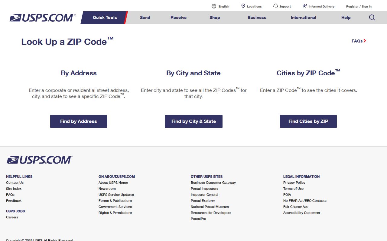
The pictured form supplies the postal half of the test. Follow it with city or county GIS whenever jurisdiction matters. A valid Huntsville mailing line may still lie beyond a specific service boundary, and a nearby mailing city may occur on land annexed into Huntsville.
Note: Keep the exact street type, quadrant, and unit because small address changes can return a different result or no match.
Huntsville ZIP Address Grammar
Huntsville's official address form is HouseNumber, StreetName, StreetType, and Quadrant. House numbers use digits and cannot start with zero. Street names begin with a letter. The quadrant is NW, NE, SE, or SW. Units use the word UNIT followed by the number; Apt, Apartment, and Suite are also accepted. Number and street name are the minimum, while type and quadrant narrow the match.
The city gives 320 FOUNTAIN CIR SW UNIT A as a valid form. A house number such as 320-A fails because letters and dashes do not belong in that field. The format matters when a ZIP code search produces no match. Normalize the address before assuming that the postal code is wrong.
| Address Part | City Format | Search Effect |
|---|---|---|
| House number | Digits only | Required parcel starting point |
| Street name | Begins with a letter | Required text match |
| Street type | Official abbreviation | Narrows similar names |
| Quadrant | NW, NE, SE or SW | Separates repeated street lines |
| Unit | UNIT plus number or accepted label | Identifies delivery point |
Huntsville ZIP Highway Aliases
Highway names are a local search trap. AL 53 may appear as Governors Drive, Jordan Lane, or Memorial Parkway. US 431 S can mean Governors Drive. US 231-431 N and US 231 S can mean Memorial Parkway. US 72 E can appear as Sparkman Drive, while US 72 W can appear as University Drive. A ZIP code directory search should try both the highway label and the local road name when the first form fails.
City and USPS abbreviations may also differ. Huntsville systems recognize pairs such as BLV and BLVD, PKY and PKWY, PKE and PIKE, PTH and PATH, and TRC and TRCE. Supported types range from ALY, AVE, CIR, and CT through LNDG, PLZ, ROW, RUN, TER, TRL, WALK, and WAY. Preserve the directional quadrant when changing only the street type.
Search tip. Try the local road name and highway alias separately, then verify the same parcel before treating both forms as one address.
Find Huntsville Residents by ZIP
The city GIS is the ZIP-wide discovery tool. Its official ZIP layer exposes the fields Zipcode and Mail_City, supports queries and distinct-value statistics, and can return JSON, GeoJSON, or PBF data with a 2,000-record maximum. The Madison County assessor cannot filter by ZIP. Its modes are Name, PIN, Company, Parcel, Account, Subdivision, and Address. That difference shapes the correct workflow.
- Verify the complete address and postal code with USPS. Keep the standardized street line and mailing city.
- Open the Huntsville ZIP boundary layer and confirm the mapped postal polygon and mail-city field.
- Compare the parcel with city-limit, annexation, and county layers. Choose Madison, Limestone, or Morgan County before opening a roll.
- Search the correct assessor by address or owner. Use the parcel and situs address to confirm the result, not the ZIP alone.
- If a lawful voter-data need exists, scope the Alabama voter-list request by city, county, or district. The personal status portal is not a ZIP browse.
Once the search narrows to a road, the Huntsville street directory explains the parcel-by-parcel method. ZIP geography remains the broad filter and should not be made to stand in for a street or household list.
Huntsville ZIP Neighborhood Context
Neighborhood names help a person interpret a broad ZIP, but association borders are not postal routes. The City of Huntsville maintains neighborhood resources and an association inventory. Those sources can connect a place name with civic meetings or city programs without publishing private member lists. They are context, not a resident roll.
Review Huntsville's official neighborhood resources alongside the postal table.

The city resource shown here is most useful after a postal search identifies a broad side of town. It can explain local civic geography, yet the GIS ZIP polygon and the USPS address test remain the relevant official tools for the mailing code.
Huntsville ZIP County Crossings
Most Huntsville records begin in Madison County, but the city extends into Limestone and Morgan counties. In 2018, Huntsville annexed 659.1 acres across the Tennessee River into Morgan County. Western growth likewise makes Limestone County a live jurisdiction question. A ZIP code can cross or touch more than one records system, so the recorder and assessor must follow the parcel's county rather than its mailing label.
Huntsville's annexation GIS includes layers for 1811 through 1949, decade layers from the 1950s through the 2020s, and individual 2025 and 2026 layers. Those dates matter for historical work. The office responsible for a parcel now may not have held the same municipal record at an earlier date. County land records, however, follow county geography, not annexation into the city.
The practical chain is short: postal code, parcel, city boundary, county, then custodian. Skipping the county check can lead to an empty assessor or deed search even when the address is valid.
Read Huntsville ZIP Terms
Postal and mapping systems use similar words for different shapes. A Huntsville ZIP code directory is more accurate when those terms stay separate. Census ZIP Code Tabulation Areas are generalized statistical shapes and not exact USPS routes. City GIS polygons are useful for comparison but still should be checked against a deliverable address.
- ZIP and ZIP+4
- A ZIP is the five-digit delivery area. ZIP+4 narrows a segment, building, box group, or other delivery unit.
- PO-box ZIP
- A code used for post-office boxes rather than ordinary street delivery.
- Unique ZIP
- A code assigned to one high-volume organization or institution.
- Carrier route
- A set of delivery points served in one postal carrier's route.
- ZCTA
- A Census Bureau approximation built for statistics, not a statement of exact postal service.
Codes 35813, 35893, 35896, and 35898 appear in the official Huntsville layer, but the research did not verify their exact institutional function. Test a real address with USPS before labeling any one of them residential, PO-box-only, or unique.
Huntsville ZIPs Versus City Limits
A Huntsville mailing address is not proof of incorporation. USPS names support delivery, while city boundaries define municipal jurisdiction. County lines select the assessor, Probate recording office, and many court records. The same address can therefore carry a Huntsville postal name, sit outside one city-service boundary, and belong to a county office that a casual ZIP search would miss.
The reverse problem also occurs. Land within Huntsville may carry a nearby postal-city label. For public records, confirm the parcel in GIS and identify the office that created the record. For mail, use USPS. For census work, use the correct statistical geography and date. The tools complement each other, but none can replace the others.
Boundary check. Never infer city services, county jurisdiction, or a person's residence from a five-digit ZIP code alone.
A ZIP search is a coarse geographic filter. It can place a street in a part of Huntsville and expose a county-line issue. It cannot prove who occupies a parcel, whether a business address is a home, or whether a protected voter lives nearby. End the ZIP code directory search at the proper official roll and keep each result within its stated purpose.